Tacoma, the harbour city north of Joint Base Lewis-McChord
Around Joint Base Lewis-McChord · Tacoma, WA
Old-growth forest on a point above the Sound, a working waterway lined with museums, a bridge made of glass and a mountain that shows itself on clear days.
Joint Base Lewis-McChord
About 45 minutes from Seattle-Tacoma International via I-5
Mild and grey from October to April, with long drizzly spells and early dark. Snow is rare. Summers are dry, bright and warm, and the mountain appears on clear days.
July, August and September
Fly to Sea-Tac, then I-5 south
Rain shell, layers, shoes that cope with wet paths
Joint Base Lewis-McChord lies along I-5 between Tacoma and Olympia, and for most visitors Tacoma is the town that does the work: places to stay, places to eat, and enough to see to fill the hours when the person you came for is on duty. It is a port city on Commencement Bay, built on hills that drop steeply to the water, with the Olympic Mountains to the west and Mount Rainier standing over everything to the south-east when the cloud allows.
Base access, visitor passes and ID requirements are set by the base and change; ask the person you are visiting, or the base itself, well before you travel. The first-trip guide lists the questions worth asking.
Landing at Sea-Tac and the drive down
Seattle-Tacoma International sits between the two cities. From the arrivals level it is usually around half an hour to downtown Tacoma and about three-quarters of an hour to the Lakewood and DuPont side, where much of the housing near the base is. I-5 is the obvious route and the obvious bottleneck; weekday afternoons southbound can double the time. If you land in the evening, plan for traffic rather than against it. Regional commuter trains also connect Seattle, Tacoma and Lakewood on weekdays; check timetables before you rely on them. The airport guide covers rental cars and arrival times in general.
While they're on duty: Point Defiance Park
Point Defiance Park takes up the whole tip of the peninsula at the north end of the city, more than 700 acres of it. Much of the point is old-growth forest, Douglas fir and western red cedar that were never logged, and you can walk under trees several hundred years old within a few minutes of a city street. Five Mile Drive loops through the park, with viewpoints over the Tacoma Narrows and across to Vashon Island; parts of the loop are closed to cars at set times so walkers and cyclists have the road. Check current hours before you go.
Below the cliffs, Owen Beach is a pebbly shore with a short promenade and picnic tables, good for children who want to throw stones into the Sound. The park also has a zoo and aquarium focused on Pacific species, formal rose and dahlia gardens, and Fort Nisqually Living History Museum, a reconstruction of a nineteenth-century trading post, which suits a morning with children. Any of these can fill half a day, and all of them are a short drive from each other.
On the way back toward the centre, Wright Park is a Victorian city park of big old trees and lawns, with a small glass conservatory full of tropical plants that makes a warm half-hour on a wet day. The streets around it, in the Stadium District, hold some of the city's grandest early houses and a high school built to look like a French chateau, which stands above the bay at the edge of the bluff. It is a pleasant, mostly level area to walk, and the views down to the port open up between the buildings.
From the park, Ruston Way runs south-east along the bay toward downtown, with a long waterfront path, small parks and piers. On a clear evening it is the easiest place in town to watch the light go off the water.
The Thea Foss Waterway and the museum district
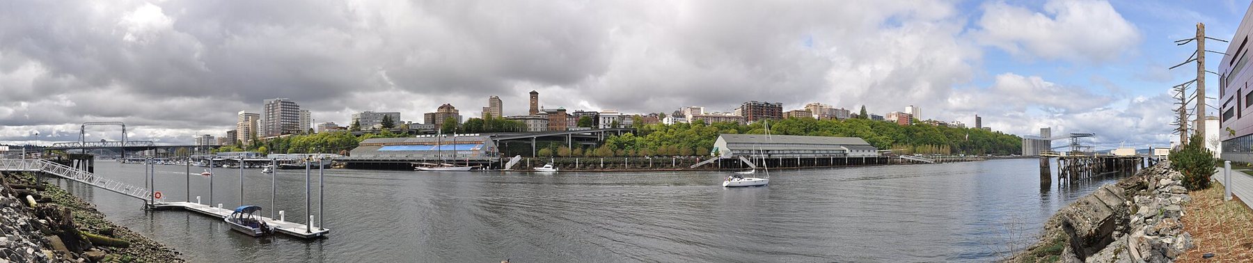
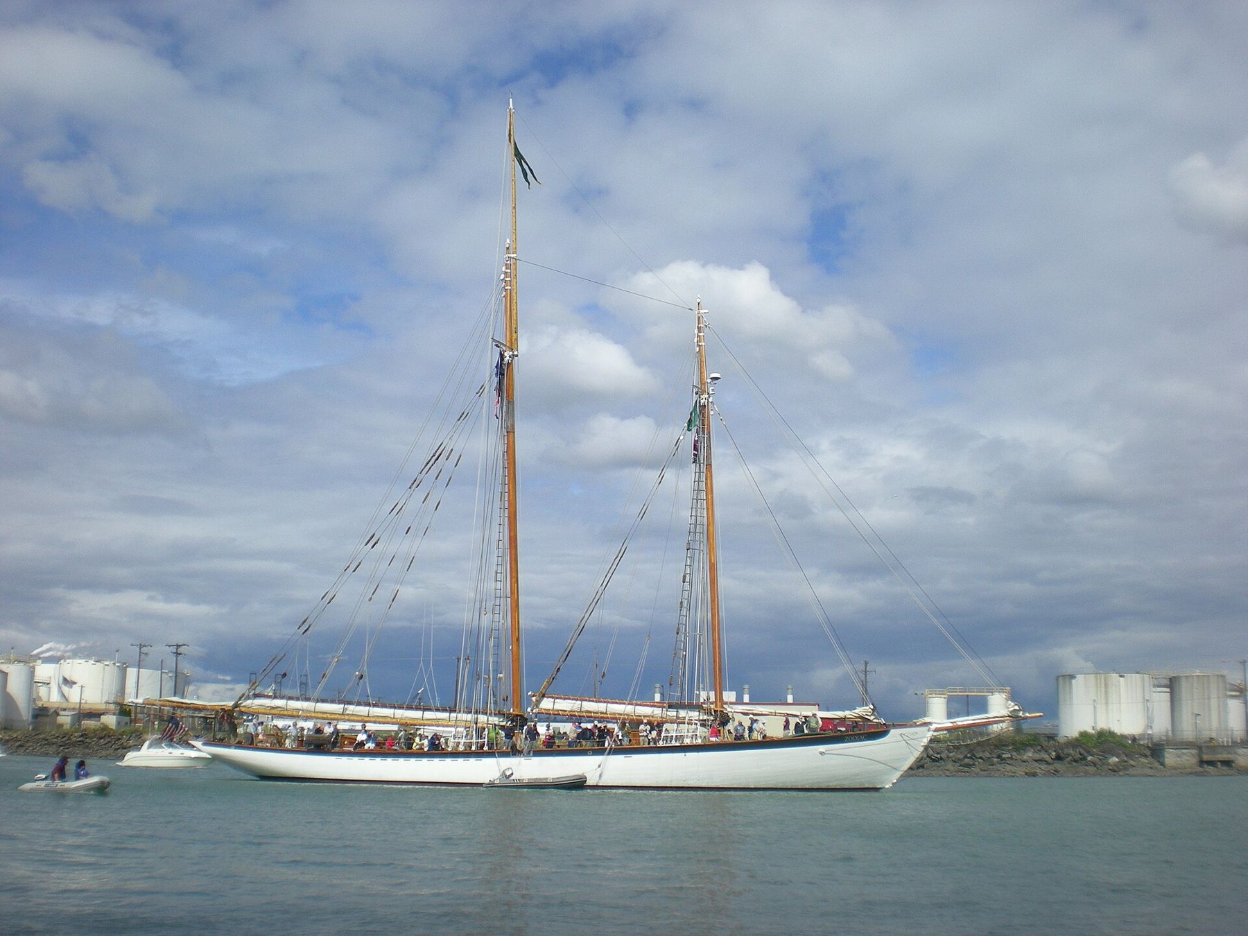
The Thea Foss Waterway is the narrow arm of Commencement Bay that runs along the east edge of downtown. It is still a working waterway, with tugs, moored schooners and marinas, but its west bank has been turned into an esplanade that you can walk for most of its length. The waterway takes its name from a Norwegian immigrant whose rowing-boat rental grew into one of the best-known tug fleets on the West Coast.
At the south end of the esplanade, the Museum of Glass is easy to spot by its tilted steel cone, which houses a working hot shop where you can watch glassblowers at work from tiered seating. Next to it, the Chihuly Bridge of Glass carries pedestrians over the interstate to downtown. The bridge carries the name of the Tacoma-born glass artist who designed it, and it is lined with cases of his glass and a ceiling of coloured pieces lit by the sky. Walking across costs nothing.
ALSO ON THE MAPA day at Mount Rainier from the Tacoma sideAt the far end of the bridge, the Washington State History Museum sits beside the old Union Station building on Pacific Avenue. Its permanent galleries run from the region's first peoples through logging, the railways and the shipyards, with a large model railroad that children tend to remember. The Tacoma Art Museum is a block away, and a little further south along the waterfront, America's Car Museum fills a long building with cars from every decade. Several of these museums have reduced or free entry on particular days; check before you go. Some posts have museums of their own on the grounds; access depends on the base's visitor rules.
On a grey day, the museums are the reason to be glad you are in Tacoma rather than a smaller town.
On a grey day, the museums are the reason to be glad you are in Tacoma rather than a smaller town. On a bright one, walk the esplanade first and keep the indoor things for later.
Closer to the base
If you only have a few hours, you do not need to drive into Tacoma at all. South of the base, the Billy Frank Jr. Nisqually National Wildlife Refuge protects the delta where the Nisqually River meets the Sound. A level boardwalk runs out over the estuary, with herons, ducks, eagles and harbour seals depending on the tide and season. Lakewood and DuPont have lakes and parks of their own, and the person you are visiting will know which are closest to where they live.
Mount Rainier itself is a long day trip from here, about two hours each way to the high meadows. The guide to a day at Mount Rainier covers the road, the seasons and what to bring.
Grey months and clear ones
From October to April, expect cloud, light rain and short days; heavy downpours are less common than the endless fine drizzle. Temperatures are mild, so a waterproof shell and a warm layer underneath do more than a heavy coat. Snow is unusual at sea level, but when it does fall the hills and the lack of ploughs can bring the city to a halt for a day or two.
Summer is the reward: July, August and early September are usually dry and bright, with long evenings and the mountain clear for days at a time. Late summer can bring smoke haze from wildfires further east. Spring sits in between, cool and changeable, with the parks at their greenest. If you are coming for a ceremony, the graduation weekend guide covers planning around crowds and weather.
Whatever the month, plan one indoor option for every outdoor one, and let the forecast choose between them on the morning.
NEXT ON THE MAP
03
EL PASOAround Fort Bliss
About 10 minutes from El Paso International
›04
JUNCTION CITYAround Fort Riley
About 2 h 15 from Kansas City International via I-70
›